By Samantha Jones-
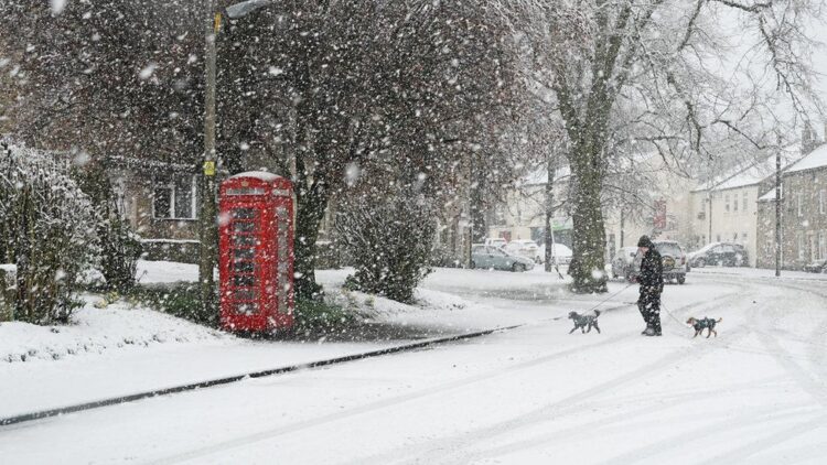
Advanced weather maps are indicating the imminent arrival of snowfall, with the first flakes expected to descend as early as Sunday, October 15.
Despite the recent warm weather, the Met Office has attributed this upcoming snowfall to the El Niño phenomenon, which is set to influence the weather patterns in the UK this year.
The British public has been enjoying the best of British summer, which has fluctuated over the years, and hardly been reliable.
This summer provided a good share of warm weather, but
El Niño, a natural climate pattern characterized by warmer-than-average sea temperatures in the tropical eastern Pacific, is typically associated with colder and drier conditions in northern Europe and the UK.
It also raises the likelihood of snowfall, particularly in higher elevation areas.
The National Oceanic and Atmospheric Administration (NOAA) officially declared the presence of El Niño on June 8 this year, indicating that the UK would likely experience its effects.
According to the Met Office, El Niño is declared when sea temperatures in the tropical eastern Pacific rise 0.5°C above the long-term average.
This phenomenon has a profound impact on the global climate, causing a chain reaction of weather events in different regions.
Weather presenter Philip Petrie from STV has cautioned that temperatures will drop significantly starting Friday night, potentially turning showers into wintry conditions, especially in the Orkney and Shetland regions.
Petrie stated, “The freezing level drops by Friday night, and showers could turn wintry, especially in Orkney and Shetland.”
The UK has already witnessed extreme weather patterns, including heavy rain and flooding in Scotland. Some areas received nearly a month’s worth of rain in just 24 hours, leading to landslips, flooding, and transportation disruptions.
Looking ahead to October 13, the Met Office anticipates that heavy rain will sweep into the southwest before spreading north-eastwards into central parts of the UK.
Northern regions are expected to see a mixture of showers and sunny spells, with the potential for strong and blustery winds in some areas. Over the weekend, a general showery weather pattern is expected, with drier conditions primarily in the southwest.
While early temperatures are predicted to be close to the seasonal average, the south may experience milder conditions initially. However, as the period progresses, the UK may experience more unsettled weather, leading to wetter-than-average conditions starting from the middle of the month.
As the UK prepares for the first snowfall of the season, many are keeping a close watch on the unfolding weather conditions, while experts continue to monitor the impacts of the El Niño phenomenon on the country’s climate.
Stay tuned for further updates on this developing weather situation as we approach the weekend.


